The Dholera–Bhavnagar Highway corridor in Gujarat lies within the influence zone of the Dholera Special Investment Region (SIR), one of India’s largest planned industrial smart cities. Administratively located in Dholera Taluka of Ahmedabad District, the corridor serves as a major road connection between Ahmedabad, Bhavnagar, and the emerging Dholera industrial ecosystem. Surrounding settlements include Adhelai, Bhangadh, Bavaliyari, and Dholera village, along with Town Planning Scheme sectors such as TP-1 and TP-2. As infrastructure and industrial development progress in the region, the highway corridor is increasingly viewed as a strategic location for future real estate and industrial investment.
Location Context
The Dholera–Bhavnagar Highway acts as a key regional corridor providing access to the broader Dholera Special Investment Region development.
- Located within the planning jurisdiction of Dholera Taluka in Ahmedabad district.
- Forms a connecting route between Ahmedabad city, Bhavnagar city, and the emerging Dholera SIR industrial zones.
- Surrounding villages include Adhelai, Bhangadh, Bavaliyari, and Dholera Village.
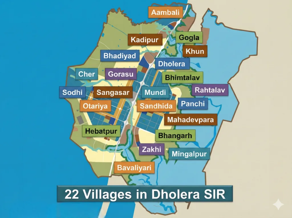
- The corridor also connects to important planning sectors such as TP-1 and TP-2 of Dholera SIR where early smart city infrastructure is being developed.
This positioning places the highway within a transitional zone where rural settlements coexist with early-stage urban and industrial development.
Connectivity & Transport
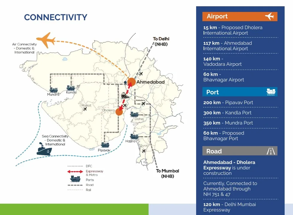
Connectivity is one of the primary drivers of the corridor’s strategic importance, especially with multiple transport infrastructure projects planned or under construction.
- Dholera–Bhavnagar Highway – The primary regional road connecting Dholera with Bhavnagar and Ahmedabad economic regions.
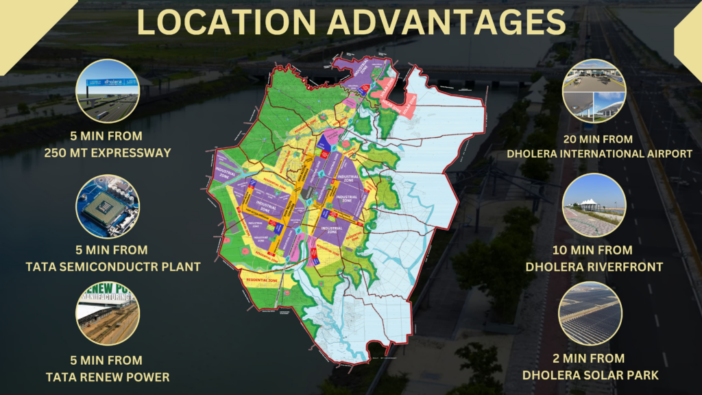
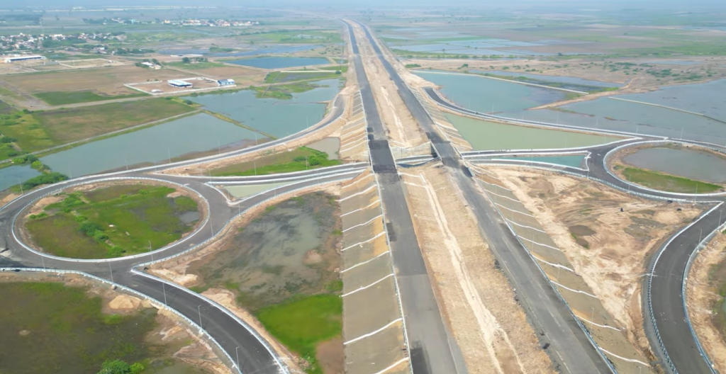
- Ahmedabad–Dholera Expressway – Located approximately 10–15 km away, this access-controlled expressway under construction is designed for speeds up to 120 km/h and is expected to reduce travel time between Ahmedabad and Dholera to under one hour.
- Dholera International Airport – Around 20 km from the corridor, the upcoming greenfield airport will feature a 3.2 km runway and planned capacity of up to 30 million passengers annually. Details about the project are outlined on Dholera International Airport development page
- Sardar Vallabhbhai Patel International Airport – Approximately 80 km away in Ahmedabad, currently the nearest operational international airport.
- Proposed MRTS / Rapid Transit – A planned metro or rapid rail system connecting Ahmedabad and the Dholera industrial zone.
- Proposed Dholera Railway Station – Future rail connectivity planned as part of the logistics network serving industrial clusters.
Nearest existing railway stations include Bhavnagar railway station (~34 km) and Tarapur broad gauge station (~103 km).
Educational Institutions
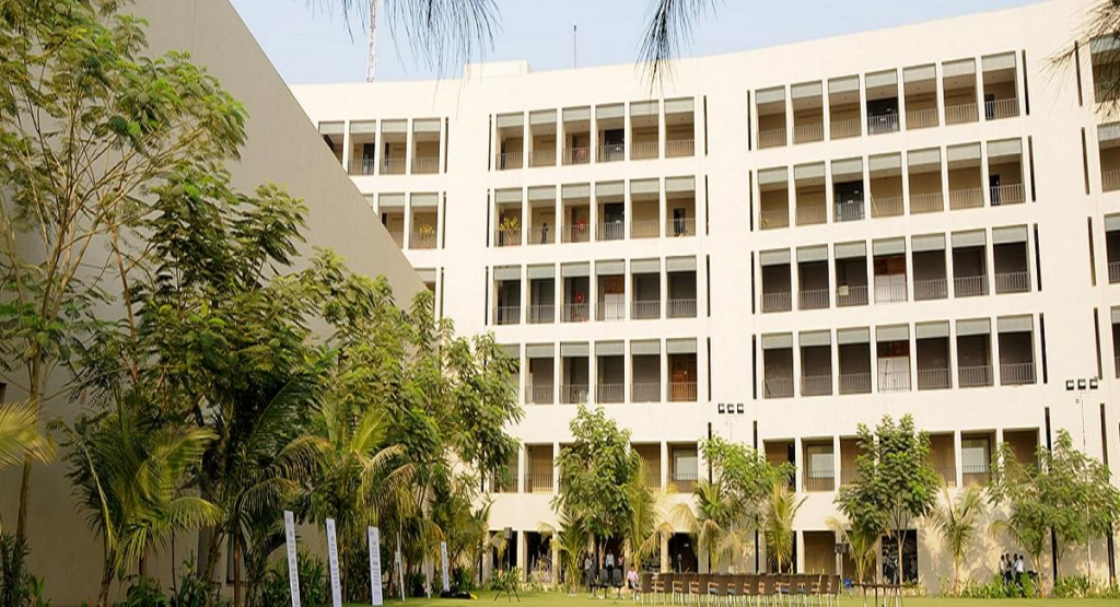
Education infrastructure around the corridor is currently limited and primarily village-level, though institutional development is expected alongside the smart city expansion.
Existing institutions nearby include
- Government Primary School Dholera – Around 2 km from the highway corridor.
- Shree Dholera Secondary School – Approximately 3 km away, affiliated with the Gujarat State Board.
Higher education institutions are located further away:
- Adani Institute of Infrastructure Engineering – Located around 65 km away in Ahmedabad, focusing on infrastructure and engineering education.
Within the Dholera SIR master plan, multiple educational and skill development institutions are proposed to support the manufacturing and technology workforce expected to emerge in the region.
Healthcare Facilities
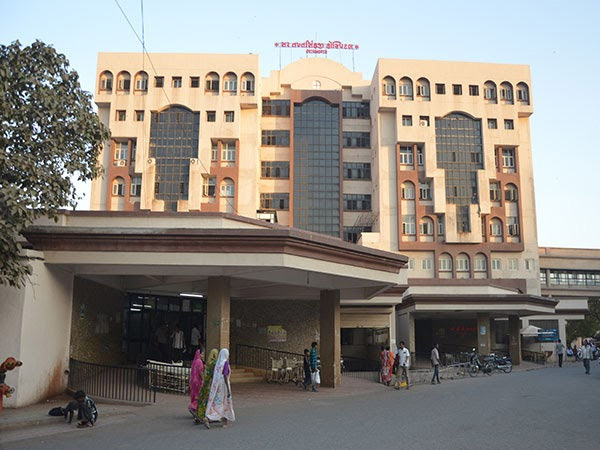
Healthcare infrastructure near the corridor currently consists mainly of government primary healthcare facilities.
Nearby facilities include
- Primary Health Centre Dholera – Around 2 km away, offering basic medical services.
- Bavaliyari Community Health Centre – Approximately 7 km away, serving surrounding rural communities.
- Sir T Hospital Bhavnagar – About 40 km away, a major multi-specialty government hospital serving the Bhavnagar region.
As population density increases with smart city development, additional healthcare facilities and private hospitals are planned within Dholera township zones.
Commercial & Retail Zones
Commercial activity in the corridor area remains in early stages, primarily centered around local village markets and planned commercial zones.
- Dholera Village Market – Located about 2 km away, providing basic retail and grocery services for nearby villages and construction workers.
- Dholera SIR Commercial Zone (ABCD Building District) – Approximately 8–10 km away, planned as the administrative and commercial hub of the smart city.
- Ahmedabad Commercial Districts – Around 80 km away, major retail and corporate zones including the SG Highway business corridor.
In addition, industrial-commercial plots are planned within Dholera SIR to accommodate logistics parks, warehousing facilities, and business centers supporting industrial activity.
Leisure & Public Spaces
The area surrounding the highway corridor offers natural coastal landscapes and planned urban recreational infrastructure.
- Dholera Coastal Belt – Located around 5 km away along the Gulf of Khambhat, consisting of open coastal terrain and ecological landscapes.
- Village Community Grounds – Local open grounds used for sports, cultural events, and community gatherings.
Future recreational infrastructure is expected as part of the smart city planning:
- Proposed parks and green spaces in TP-1 and TP-2 sectors of Dholera SIR.
- Smart city recreation zones integrated within township planning.
Government Projects & Infrastructure
The corridor’s development potential is strongly linked to several large-scale infrastructure and industrial initiatives.
- Ahmedabad–Dholera Expressway – A 109 km expressway being developed by the National Highways Authority of India to improve connectivity between Ahmedabad and Dholera.
- Dholera Special Investment Region (SIR) – A planned smart city spanning approximately 920 sq km developed under Delhi–Mumbai Industrial Corridor program .
- Dholera International Airport – A greenfield international airport project expected to support regional passenger and cargo movement.
- Semiconductor Manufacturing Ecosystem – Supported by Gujarat government industrial policies aimed at establishing semiconductor fabrication units.
- AI Data Centre Campus – Proposed 250 MW hyperscale data centre by L&T Vyom with an investment of around ₹25,000 crore.
- Dholera Port Project – A planned seaport that will connect with regional highways to support industrial logistics.
These infrastructure initiatives collectively position the region as a future manufacturing and logistics hub.
Private Developments
Several private developers have launched plotted township projects along the Dholera–Bhavnagar Highway corridor to cater to anticipated residential and investment demand.
Key projects include:
- ALFA City Dholera – A township project by Buddy Realty and Dolphin Infra covering approximately 150 bigha with residential and commercial plots.
- Serenity Estate Dholera – A plotted development project with internal roads, green spaces, and clubhouse facilities.
- Orange County Dholera – Residential plotted development located near TP-1 and TP-2 sectors.
- Mulberry Park Dholera – Township featuring residential plots and villas near the central spine road.
- Aerox Dholera – A plotted development project in the Dholera SIR influence zone.
These developments are primarily land-based investments anticipating long-term appreciation as infrastructure progresses.
Environmental Conditions
The region features a semi-arid coastal landscape typical of the Gulf of Khambhat area.
Key environmental characteristics include:
- Sparse natural vegetation with open terrain.
- Planned green belts and landscaped zones within the Dholera smart city planning framework.
- Bulk water pipeline infrastructure proposed to support urban water demand.
- Smart drainage and flood management systems integrated into Dholera SIR trunk infrastructure development.
These environmental infrastructure systems are part of the planned urban development approach for the region.
Economic Activity
Economic activity in the corridor is closely linked to industrial development within the Dholera SIR ecosystem.
Key drivers include:
- Industrial zones located approximately 5–10 km away focusing on manufacturing sectors such as electronics, defense production, renewable energy equipment, and heavy industry.
- Semiconductor manufacturing projects planned within the Dholera industrial ecosystem.
- AI Data Centre Campus proposed by L&T Vyom to support large-scale cloud and AI infrastructure.
- Strategic alignment with the Delhi–Mumbai Industrial Corridor, which aims to create integrated manufacturing and logistics zones across western India.
These initiatives are expected to attract industrial investment, logistics companies, and supporting service industries over time.
Real Estate Impact Summary
From a real estate perspective, the Dholera–Bhavnagar Highway corridor represents an early-stage development zone with long-term infrastructure-driven potential.
Positive investment factors
- Proximity to Dholera SIR, one of India’s largest planned smart city projects.
- Upcoming infrastructure including the Ahmedabad–Dholera Expressway and Dholera International Airport.
- Large-scale industrial initiatives such as semiconductor manufacturing and AI data centers that may generate employment demand.
- Availability of large land parcels suitable for plotted developments and future township planning.
Limitations investors should consider
- The region is still in an early development phase, meaning infrastructure and population growth may take time to materialize.
- Limited existing social infrastructure such as higher education institutions, hospitals, and retail centers within immediate proximity.
- Current demand for residential real estate is primarily investor-driven rather than end-user occupancy.
Overall, the corridor’s real estate outlook is closely tied to the long-term success and execution of Dholera SIR infrastructure and industrial development plans.